


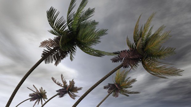
The National Hurricane Center’s updated its tropical storm warning for the Gulf Coast is in effect for east of Morgan City, Louisiana to the Okaloosa/Walton County line in Florida.
The center has warned of heavy rainfall and flooding.
On Friday, at 10 am CDT, the storm was about 220 miles south of Morgan City, La. and about 340 miles south southeast of Mobile, Ala.
A tropical storm warning means that tropical storm conditions are expected somewhere within the warning area within 36 hours.
The system was moving toward the north near 14 mph, which NHC said could increase.
The system is expected to produce heavy rainfall and considerable flash, urban and small stream flooding beginning Friday and continuing through the weekend along the central Gulf Coast and spreading northeastward into the southern Appalachians, according to NHC. Rainfall totals of 4 to 8 inches with isolated maximum amounts of 12 inches are possible beginning Friday and continuing through the weekend.
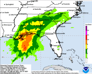
NHC said that as the system continues to lift northeast through the weekend, heavy rain is expected to expand across southeastern Mississippi, southern and central Alabama, and central Georgia resulting in rainfall totals of 3 to 5 inches with isolated maximum amounts of 7 inches. Flash, urban, small stream and isolated minor river flooding impacts are possible.
NHC warned that the combination of storm surge and the tide will cause normally dry areas near the coast to be flooded by rising waters moving inland from the shoreline.
The threat for a tornado or two will begin this afternoon across coastal Louisiana, then spread overnight into Saturday across southern portions of Louisiana, Mississippi, and Alabama, to the western Florida Panhandle.
Maximum sustained winds are near 35 mph with higher gusts.
 U.S. P/C Industry Books Best Result in a Decade, but Not All Lines Enjoy Success
  Wendy’s, Chipotle Not Affected by Cyclosporiasis Outbreak
  Two Trailers Containing $1.3M in Stolen Copper Wire Recovered in Illinois
  Duck Creek Acquires Send, Creating Agentic Underwriting-to-Core Platform

