


With two hurricanes forming in the Atlantic, Florida and the rest of the Atlantic seaboard are bracing for their impact.
While Hurricane Franklin is only expected to bring with it considerable wind, Idalia could cause more damage, depending on its category level upon landfall.
Franklin took a gradual turn toward the north and north-northeast, according to a public advisory issued by the National Hurricane Center (NHC).
A slightly faster forward speed is expected during the next couple of days, the forecast advisory stated.
Maximum sustained winds have increased to near 115 mph (185 km/h) with higher gusts, making Franklin a category 3 hurricane on the Saffir-Simpson Hurricane Wind Scale, the NHC said.
Additional strengthening is forecast today, with gradual weakening expected to begin by Tuesday afternoon.
Wind speeds are expected to impact the East Coast of the U.S. throughout the week.
Swells generated by Franklin are affecting Bermuda and are expected to spread toward the east coast of the U.S. during the next couple of days, possibly resulting in life-threatening surf and rip current conditions, the advisory warned.
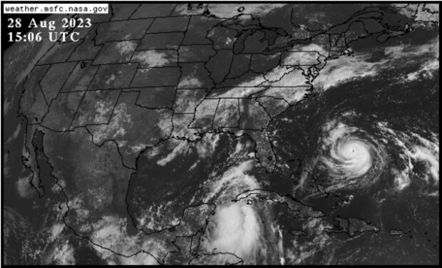
Meanwhile, Hurricane Idalia is forecast to become a hurricane when it nears Cuba later today, and a dangerous major hurricane over the northeastern Gulf of Mexico by early Wednesday, the NHC warned.
It will reach the Gulf coast of Florida sometime Wednesday, bringing with it life-threatening storm surge and dangerous winds.
Maximum sustained winds are near 65 mph (100 km/h) with higher gusts.
 The Price of Loyalty: How Higher Premiums Are Reshaping Carrier Retention
  How Insurers Know When It’s Time to Scale AI
  Older Buildings, Substandard Construction Left Venezuela Vulnerable to Earthquakes
  How to Improve Small Commercial Property Underwriting