


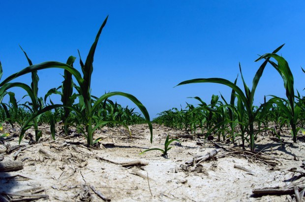
Drought conditions across portions of the central United States continued to moderate as rain and snow boosted soil moisture in the past week, according to a report released on Thursday by state and federal climatologists.
The “Drought Monitor” report, which tracks the land area affected by drought, said the High Plains, the region suffering the most from drought, was seeing significant relief.
“It’s a really good start,” said Brian Fuchs, a climatologist with the National Drought Mitigation Center at the University of Nebraska. “A lot of places in Nebraska, we haven’t seen rains like we’ve seen in the last couple weeks in over a year.”
The report said climatologists calculated that 69.80 percent of the High Plains, which include Nebraska, Kansas, Colorado and the Dakotas, was in severe or worse drought, down from 73.47 percent the prior week. Severe drought is considered the third-worst level of drought, which extreme being the second-worst and exceptional drought being the worst.
Extreme drought levels also shrank, though exceptional drought climbed to 7.32 percent of the High Plains, from 6.77 percent the prior week.
“The deficits are still large and it is going to take timely rains through the growing season to alleviate the dry impacts of 2012,” said Fuchs.
Last week’s storms brought two to three inches of precipitation to parts of Kansas, and 3.5 inches were noted near the Nebraska border, the report said.
Oklahoma also saw some improvement in drought conditions.
Heavy rain and wet snow also eased long-term drought across western and northern portions of the Midwest. Precipitation of one to three inches was noted from northern Minnesota into the Upper Peninsula of Michigan, while totals of two to six inches were seen from southeastern Minnesota into central Iowa, northwestern Missouri, and southeastern Nebraska.
(Reporting by Carey Gillam; Editing by Steve Orlofsky)
 The $400,000 Chief of Staff Is the CEO’s Secret Weapon in the AI Age
  Why Consistency Beats Creativity in Insurance Marketing
  Deja Vu as Berkley Calls Out MGUs During Quarterly Call
  This Year’s SCS Loss Totals Will Fall Below Average: KCC Analysis