


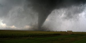


Reporting on the latest earthquake to strike New Zealand earlier this week, catastrophe modeling firm AIR Worldwide said the magnitude 6.2 quake was one of many to shake the region over the years.
The region within 200 km of the most recent event has experienced 35 earthquakes of M5.5 or larger during the past century, AIR said in an announcement Monday, detailing early damage reports from Jan. 20 event (3:52 local time) striking New Zealand’s North Island.
The epicenter was located 111 km (69 miles) northeast of Wellington, New Zealand’s capital city and second most populous area, and 34 km (21 miles) south-southeast of Palmerston and 37 km (23 miles) north-northeast of Masterson, AIR reported.
This event, according to AIR, is just a few kilometers to the east of an M7.3 earthquake that struck in March 1934, and it roughly 40 km southwest of an M6.2 and an M6.4 earthquake near Dannekirke in March and May of 1990, respectively.
The 1990 events did not cause significant damage or fatalities.
In 2011, a 6.3-magnitude earthquake hit the city of Christchurch, in the South Island, killing 185 people.
As of Monday’s analysis of the latest event, AIR said damage to houses and their contents, power outages, rail service suspension road closures, and a chemical spill had been reported.
Nearly 30 aftershocks had also been reported, most of which were less than M4.0.
Nearest the epicenter—in Palmerston North and environs as well as Masterson where strong shaking was felt—there were reports of damage to houses and their contents, including chimneys down and broken, windows broken, fences toppled, and items fallen off shelves and walls.
According to AIR, the eastern margin of the Australia plate is one of the most seismically active areas in the world due to high rates of convergence between the Australia and Pacific plates. New Zealand lies along the 3,000 km long tectonic boundary of the Australian and Pacific plates.
Source: AIR Worldwide
 Illinois Could See Highest Catastrophe Claim Volume in a Decade: State Farm
  USAA Not Done With Dividends: Florida Reforms Prompt $0.5B Payout
  The 24-Hour Window: The Race to Keep Claims Out of Litigation
  NY Man Sentenced for Fencing Organized Crime Ring’s $4.4M Jewelry Theft