


















When Mike Fitzgerald, an insurance technology expert, talks about geospatial technology and its applications in property/casualty insurance, he finds it challenging to restrain his enthusiasm about the subject.
“I really do view this as the next big thing—on the order of the Internet, on the order of mobile phones,” said Fitzgerald who is the guest editor for the content of this edition devoted to the current and potential uses of geospatial information systems in insurance. With insurers now able to access data from cameras and sensors positioned aboard satellites, drones and manned airplanes, to store the information in the cloud, and to use artificial intelligence to apply what sensors capture to the business problems of insurance, “we can’t even imagine how we’re going to take advantage of it,” he said.
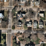
In a series of articles, and in accompanying video content published online, Fitzgerald connects with representatives of all corners of the P/C insurance industry to describe some of the ways in which property/casualty insurers are using information satellite and aerial imagery including:
- Automating property inspections to improve pricing and underwriting processes.
- Enhancing flood maps and information in catastrophe risk models.
- Tracking supply chain risks and marine transportation backlogs.
- Developing new insurance products with parametric triggers for weather-related small business interruptions, event cancellations and crop yield coverages.
- Improving catastrophe responses to get to customers in their time of need.
“You can create this bespoke, concierge-level experience all while doing it even more efficiently than you are now, because you often don’t have to put people in the field,” Ryan Bank, managing director of the Geospatial Insurance Consortium, told Fitzgerald in one video interview, emphasizing the last bullet point. Bank described the phone conversation between an insurer’s service representative and an insured that had to evacuate a storm- or wildfire-damaged property, with the carrier rep offering to have clothes and supplies delivered to the policyholder—a conversation triggered by an image of the insured’s home delivered to the insurer the day after a natural disaster.
GIS information isn’t just beneficial to property insurers, Fitzgerald said. “If you think about a retail location, many times general liability is [evaluated based] on sales…The number of sales you have represents the number of people you had on site, which represents your risk. But there is the ability now to just look at how many cars are in the parking lot and track that over time, and then come back and adjust the premium” using factors beyond sales receipts by tapping into information from aerial images, he said.

Featured Articles: Eyes in the Sky and Beyond (CM Q42021)
- A Top-Down View of Insurance Risk: Understanding the Geospatial Insurance Consortium
- Seeing Through Clouds: Why Now Is the Time for Geospatial Technology in Insurance
- Beyond Claims: How Carriers Use Geospatial Analytics to Underwrite Property
- Found in Space: How Skytek Tracks Supply Chain Risks—and More
- Meet the Guest Editor
Click here for a free PDF copy of Carrier Management’s Q4 2021 edition “Eyes in the Sky and Beyond.” To be able to read and share individual articles more easily, consider becoming a Carrier Management member to unlock everything.
Referring to the growing impacts of climate change on insurers, and on vulnerable populations in harm’s way, speakers participating in a CM Roundtable moderated by Fitzgerald—Pranav Pasricha, global head of P&C Solutions for Swiss Re; Bessie Schwarz, the CEO of Cloud to Street (a group of scientists engaged in flood mapping); Giacomo Favaron, a pricing and GIS data specialist from AXA XL; and James Rendell, CEO of BirdsEyeView, an MGA developing parametric products based on satellite data—agreed that revolutions in space technology and AI hold the promise of creating a world that is safer through loss control activities and coverage developments to fill protection gaps, all made possible with geospatial information. (Related article, “Seeing Through Clouds“)
Science and Business Model Changes
All of these possibilities start in the sky—with ultra-sensitive cameras the size of mini-refrigerators on board airplanes capturing high-resolution images of ground activity—and in space, where satellite constellations with radiometers can see through clouds and process spectrums of light that the human eye cannot see.
“When scientists start talking about the ability to look at not just two or three different color spectrums but 25 or 26 at one time, or when you hear them reference [developments] like government satellites that are not commercially available yet, which can measure one inch of sea-level change from 800 miles above the Earth,” you begin to understand the enormity of the technological advances that are actually out there, Fitzgerald said, recapping some highlights of the video Roundtable, which he moderated.
“That’s the reason that I think we haven’t even begun to tap into the number of applications and the number of possible use cases. [And], I don’t think this is a 10-year away thing. There’s going to be a huge entrepreneurial push around figuring out creative and useful ways to use the data and combine the data and deliver it back.”
Fitzgerald introduced the topic to Carrier Management with a definition of GIS and a seven-year view of what is happening in space, going on to discuss changes in insurer business models that will happen over time.
“GIS is a collection of technologies involved with mapping the Earth—and with deriving insights from information that help explain what is happening on our planet,” he said, providing a basic definition.
“An important aspect of a GIS is interpreting and making sense of the data—using analytic tools such as artificial intelligence to assemble the range of geospatial data into a layered set of maps, allowing complex themes to be analyzed and then communicated to wider audiences,” he said. “This ‘layering’ is enabled by the fact that all such data includes information on its precise location on the Earth’s surface.”
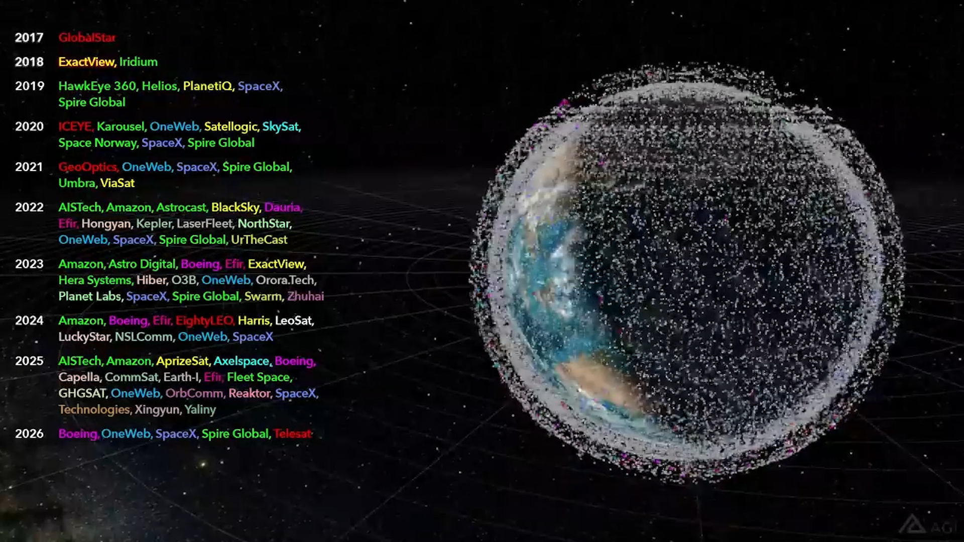
Attributing the definition to the American Association for the Advancement of Science, Fitzgerald also shared a mesmerizing video (with permission) from AGI, a provider of simulation, modeling, testing and analysis software for aerospace, defense and intelligence applications. Tracking developments in the satellite world, the video depicts the number of vendor applications for licenses to launch satellites at various points in time as dots around the globe, Fitzgerald explained. At the start of the video (1.25 minutes in on video at right), the Earth is clearly visible behind a sparse collection of dots in 2019, and then partially obliterated by multiple dots in 2021. Five years later, it’s hard to see the Earth’s landscape, which is hidden behind an array of dots coming together to form a veil around it, representing the explosion of satellite launch applications through 2026.
But “this is not all futuristic and about ‘Star Wars’ R&D,” he noted. “It’s about business process innovation,” he said, going on to describe the work of space technology companies Planet and Skytek, which helped insurers track risk accumulations from supply chain disruptions that ensued when the Ever Given ran aground in March of this year and to pinpoint the cause of the event. (See related article, “How Skytek Tracks Supply Chain Risks—and More“)
“Within hours, Bloomberg published some facts that even five years ago wouldn’t have been available,” he said, noting that the news organization accessed Planet’s satellite data, as well as publicly available weather data, to illustrate that this ship was actually speeding through the canal while there were very high winds that were blowing across at a certain direction, that basically turned it in the narrow channel and ran it aground.”
“Previously, the business model would have been for insurers to send risk managers to the site, try to get access to the black box recordings, try to get GPS information to determine the speed of the vehicle, the speed of the ship, but it wouldn’t have been public information,” Fitzgerald said. “It became public almost instantaneously, therefore allowing insurers to take a different approach.”
Turning to the work of Skytek, Fitzgerald said the company was able to match up satellite images with ship manifests—unstructured photo data with structured company data that was publicly available—to produce reports that identified which ships were stuck and where. No longer do insurers, brokers and shipping companies have to scramble to figure out where insured assets are located and what the risk aggregation impact might be, he said.
“If you think Google Maps and Navigation is cool, then hold on, because we’re going to have a whole lot more with these capabilities,” Fitzgerald said.
For insurers, the new world opened up by GIS may seem daunting, with firms specializing in satellite and aerial imagery data collection, insurance-specific turnkey apps, and geospatial data analysis tools all proliferating.
How can they sort through the possibilities?
“The important thing is not to wait to start,” Fitzgerald said, warning against inertia on the part of insurers. “Anything that an insurer that is not currently involved with geospatial can do will position them better,” he said. “Property lines of business are a great place to start. And marine has a ton of applications, too. But I would look for some line of business which is strategically important for insurers. And then look at the different solutions that are out there, particularly from the standpoint of have these solutions operated in insurance before…There are some vendors that are out there that are quite sophisticated in GIS but also who have delivered it to an impressive list of insurers,” he said.
(Editor’s Note: At the time this article was first published in late 2021, Fitzgerald was a principal insurance analyst for CB Insights. In 2022, he joined SAS as an advisory insurance consultant.
Last year, CB Insights published a report on Geospatial Analytics in P&C Insurance, presenting an “ESP Matrix” of GIS vendors, assessing them on execution and market strength, as well as relative positioning in the technology category.)
 Oversight, Safety Questions Raised in Deadly Brooklyn Building Collapse
 Binance $6.3B Theft Prompts Closer Scrutiny by Insurers
 Captives Weren’t a Hard Market Moment; They’re a Permanent Shift
 How AI Tracks Digital Footprints to Uncover Fraud