To the average person, aerial imagery and satellite imagery are thought of as interchangeable technologies that have similar processes and produce similar end results. However, this could not be further from the truth.
Executive Summary
Opinion: Tony Agresta, an executive at Nearmap, a provider of high-resolution aerial imagery, artificial intelligence data sets and geospatial tools offers his take on why he believes aerial imagery provides better support than satellite imagery for the insurance underwriting process. Among his reasons, with aerial imagery insurers can “cherry pick” the day and time they want to fly a location.When we look at the results these technologies yield, there’s a clear difference and frontrunner when it comes to which provides higher quality images that align with the imperatives and demands of insurance companies. And in an industry founded on the need for accuracy, those distinctions make all the difference for insurers and their customers at every stage of the insurance lifecycle.
How aerial and satellite imagery compare
While aerial imagery and satellite imagery technologies can both secure visual assets from a vantage point in the sky, that’s where the similarities end. Satellite images typically cover a much larger expanse of land, generating large-scale scientific demand, whereas aerial imagery is taken from a lower altitude in the air which shrinks the amount of land it’s able to capture at any given point. But the level of detail on these images is leaps and bounds above that of satellite imagery—and that level of detail is what insurance companies have come to expect. As a result, insurers are able to leverage stronger insights to inform their work, including the creation of customer quotes, land assessments and property risk assessments.
And these variances in technology can be seen in the work of insurers. For example, satellite imagery will provide insurers with visuals at a 30–50-centimeter resolution which generally obtains a relatively clear image of a house. Aerial imagery’s 5.5-7.5-centimeter resolution is so detailed that it enables insurers to count the number of tiles on the roof of that house, if needed.
But the difference in detail between satellite and aerial imagery is just one example of how the two visual tools contrast each other. Aerial imagery is a critical tool for insurers to incorporate as it provides greater autonomy in the photo-capture process. This allows insurers to “cherry pick” the day and time they want to fly a location to obtain the most optimal photos. With satellite imagery, the technology is almost entirely autonomous and captures images from a greater altitude, which can lead to grainier photos that are often unusable.
Building greater accuracy in the insurance industry
The one advantage of satellite imagery over aerial imagery is that it can be taken more frequently. But there is no guarantee the visuals can be used as a completely accurate source of truth. More often than not, these photos must be taken multiple times just to obtain one usable image. Aerial imagery technology removes the guesswork from the photo-capture process, ensuring a higher level of quality with every picture taken.
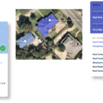
Aerial imagery technology is a jack of all trades because there’s more than meets the eye when it comes to the insights a person can derive. Unlike satellite imagery, aerial imagery technology affords insurers with an extensive portfolio of imagery that ranges from oblique imagery—pictures that are taken at a 45-degree angle to glean additional insights of photographed landmarks for risk assessment—to top-down or 90-degree (orthogonal) images. Visual data collected from these vantage points plays an important role in assessing key risk variables like roof slope and land elevation, along with plotting vulnerable spots on architecture such as doors and windows.
This data supports the accurate and efficient measurement of risk and informs the insurance underwriting process. And as new technologies emerge, these insights are only strengthened. Machine learning advancements, for example, have catalyzed new visual processes like image recognition, which insurers can incorporate to support the examination of millions of images each year and automatically categorize them based on similarities. This new wave of digital transformation spells big innovations in the way insurers go about their work, and aerial imagery is a foundational piece of continuing to drive that progress.
Flying higher with aerial imagery
The insurance sector has been on the receiving end of several updates in recent years—automated underwriting and the introduction of virtual assistants, or chatbots as they’re more commonly known, to name a few—with the goal of expanding solution capabilities and scalability of work. Aerial imagery technology joins the ranks of such advancements that are equipping insurers with the tools and knowledge they need to remain ahead of the curve.
With the resolution of aerial imagery technology continuing to advance at an unrelenting pace, insurers can bank on even greater image quality in the near future. In recent years, we have seen resolution jump from 10 centimeters to 7.7 centimeters all the way down to an impressive 5.5. centimeters. With 3-centimeter resolution on the horizon, the accuracy of aerial imagery will approach the quality of visuals captured by drones. This will allow insurers to see three-inch objects with stunning clarity and provide customers with the most high-quality, accurate solutions possible.
Furthermore, applications are being developed that will allow insurers and customers to see much more than what’s visible to the naked eye. Viewers will be able to incorporate infrared band applications to assess moisture and damage caused by a flood or hurricane. Even if that damage is not immediately visible to customers or insurers, there must be a way to quantify that impairment accurately. Aerial imagery coupled with infrared band technology will help achieve that goal. This information arms insurers with an even more nuanced perspective of the areas in question, even from afar, which can act as the make or break in how accurately land is assessed, quoted and insured.
There is virtually no industry that has not been impacted in some way by aerial imagery. But there is no sector more greatly impacted by the ongoing evolution than the insurance industry. While satellite imaging technology possesses adequate capabilities, there is no substitute for the highly detailed, impactful visuals that aerial technology provides insurers with on an ongoing basis.
As these transformations progress, aerial imagery will have pride of place in every insurance company’s arsenal of tools, further revolutionizing and democratizing the claims process for key stakeholders in the insurance industry.
Photo: Oblique Image, Raleigh, N.C. provided by Nearmap
 Wendy’s, Chipotle Not Affected by Cyclosporiasis Outbreak
  Executives on the Move at Arch, Allstate, Everest
  Executives on the Move at SiriusPoint, Canopius Group, Badger Mutual
  AI Pushes Underwriting Beyond Risk Selection to Prevention