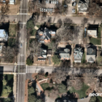
One of the best-kept secrets about the property/casualty insurance industry is a member-centric organization that manages the largest aerial imagery program in the world.
Executive Summary
"Insurance touches everything, and everything that insurance touches has a location." Ryan Bank, the managing director of the Geospatial Insurance Consortium, explains the history and the business model of the GIC, a member-centric organization that gives insurers aerial views of every location they need to analyze at costs they can afford. Watch related videos: "The World's Largest Aerial Imagery Program—Managed by Insurers" and "A Top-Down View of Insurance Risk: Unlocking the Benefits of Geospatial Technology" on the Carrier Management channel of InsuranceJournal.TV Photos supplied by GIC and VexcelThat’s right. The world’s largest high-resolution aerial imagery program in existence isn’t something that was developed by Google or Microsoft. It was created by insurers and reinsurers, who also pay to keep a fleet of fixed-wing aircraft equipped with special cameras flying over every square inch of the continental U.S., most of Canada, Puerto Rico, all of Western Europe, the UK, Scandinavia, Australia and New Zealand.
“And we just announced our expansion of the GIC consortium into Japan as well,” Ryan Bank, the consortium’s managing director, reported recently.
Even with more than a hundred manned planes flying through the clouds over the U.S. alone, the Geospatial Insurance Consortium (GIC) was an under-the-radar organization to Carrier Management until Guest Editor Mike Fitzgerald interviewed Bank in October.
The GIC, conceived by the National Insurance Crime Bureau, is a partnership between NICB and Vexcel, a provider of camera sensors and image processing technology. Vexcel’s team and technology developed Microsoft’s Bing Maps, Bank said, going on to explain the nonprofit cost-sharing model that makes the GIC possible to Fitzgerald.


