


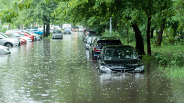
The likelihood of El Niño may increase the chances of high tide flooding along the U.S. Coast, according to the National Oceanic and Atmospheric Administration’s (NOAA) National Weather Service.
Though it’s too early to tell how strong El Niño will be, scientists know that the weather pattern “can affect weather significantly, as warmer waters cause the Pacific jet stream to move south of its neutral position.”
This can result in elevated sea levels along the west coast of the U.S., causing high tides and strong surf to push much further inland than normal.
Along the Atlantic coast, a shift in the jet stream often steers storms towards the mid-Atlantic, resulting in more storm surge events, the weather agency said.
Higher than normal rainfall can also occur along the U.S. Gulf and Southeast Coasts.
Over the last few decades, NOAA scientists studying high-tide flooding have noticed an uptick in flooding in many locations, even when compared to previous strong El Niños during 1982-1983 and 1997-1998.
With a possible El Niño developing between now and December, the chances of high-tide flooding impacts could be even stronger, NOAA researchers said.
“It usually ends up being a double whammy,” said NOAA oceanographer and high tide flooding expert William Sweet, Ph.D, noting that the especially strong El Niños in 2015-2016 and 2023-2024 brought much more frequent flooding. “The first punch is decades of sea level rise, which has waters close to the brim in many coastal communities. And now with this second punch – a strong El Niño – coastal communities face more frequent, deeper, and widespread high tide flooding along both the West and East Coasts.”
 California Theft Crew Busted, Responsible for $1.3M in Stolen Vehicles
  Two Trailers Containing $1.3M in Stolen Copper Wire Recovered in Illinois
  NY AG Suing 3M, Other Chemical Companies Over PFAS Pollution
  Leadership Change at Vantage: Former Arch Execs Grandisson, Gansberg to be Chair, CEO