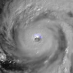
ICEYE, a provider of SAR (synthetic aperture radar) satellite data, revealed on Monday morning that a total of 358,858 Florida properties have been impacted by flooding from Hurricane Ian, based on an updated analysis.
Inundation levels were about 2 feet for 24 percent of the properties—over 84,250 properties. Of these, more than 13,300 properties had flood levels of 5 feet of more, the ICEYE analysis showed.
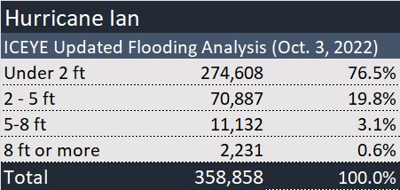
An initial estimate had indicated a higher percentage of properties under the 2 foot mark (85 percent vs. 77 percent for the current analysis).
ICEYE said that while the updated numbers cover almost the full totality of the regions that were hit hardest in Florida, encompassing information for more than 2 million properties, analysis continues and numbers are again subject to change.
Source: ICEYE
***
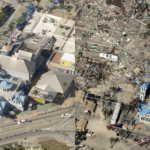
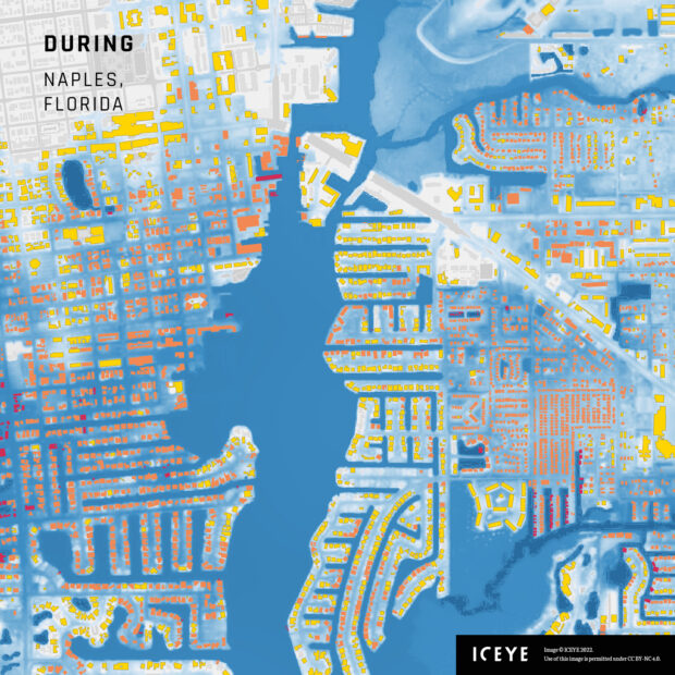
The image of Naples, Fla., accompanying this article, provided by ICEYE on Sept. 30, shows the extent of flooding in that area during Hurricane Ian. The colored areas represent flooded buildings, with red areas indicating the greatest amount of flooding (yellow, the least; orange, mid-level flooding).
 AI Pushes Underwriting Beyond Risk Selection to Prevention
  AI Adoption Continues, But 70% Want More Training: SMB Survey
  Leadership Change at Vantage: Former Arch Execs Grandisson, Gansberg to be Chair, CEO
  Self-Driving Car Firms Must Address Emergency Vehicle Interference