


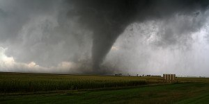


While wind damage has been significant, most of the loss from three winter storms in Europe late last week is coming from flooding, AIR Worldwide reported Saturday.
A series of three winter storms—named Christian, Dirk, and Erich—cut power to hundreds of thousands of homes across the UK and France and flooded an estimated 1,200 homes across the UK. As of Friday afternoon local time, an estimated 13,000 homes were still without power. Trains, ferries, and aircraft have experienced significant delays and cancellations.
There are reports of damage across the UK due to Dirk. At one point, approximately 300,000 properties in the southeast and east of England lost power, mainly due to falling trees and branches.
In the UK, the Environment Agency issued more than 350 flood alerts and flood warnings and three severe flood warnings (indicating life-threatening conditions).
In France, an estimated 200,000 homes in western and northern France were left without power.
According to AIR, the third storm of this cluster, Erich, was impacting the UK on Saturday and was expected to cause additional damage, mainly flood-related, and impede repair efforts. The Met Office has issued yellow and amber warnings for northern England, Northern Ireland, and parts of Scotland. The Environment Agency has issued well over 100 flood alerts and warnings across all England. Much of England is expected to see gusts of up to 80 mph (129 km/h). While rainfall amounts are not expected to be extreme, the ground is saturated from previous storms, leading to the danger of flooding from rivers and streams that are already at high levels.
Storm Clusters
According to AIR, extratropical cyclones, also known as winter storms, form when a warm, tropical air mass interacts with a cold, polar air mass, creating local atmospheric disruptions that can grow into powerful storms. The fronts that created this latest series of storms were exceptionally warm and cold.
Storms in Europe have a tendency to cluster, with several affecting an area in close succession. This can happen with relatively weak storms, as demonstrated by this past week’s storms, or with very powerful ones, like 1999’s Lothar and Martin, which were separated by 36 hours and caused billions of euros in damage.
According to AIR, last week’s clustered storms also showed a characteristic alternation between wet and dry periods, whereby a warm, humid front dropping significant amounts of precipitation on an area is pushed by a “dry slot” containing powerful winds. Following that, a cold front arrives and lifts warm, moist air higher into the atmosphere where it cools and falls as precipitation.
Systems with a southwest to northeast path, like the storm cluster that affected the UK this week, typically bring more rain to Europe than systems that travel from the northwest to southeast. Systems that originate in colder environments and move southeast into warmer regions—like Xaver earlier this December—generally have less moisture and less precipitation compared to storms that originate in warmer regions.
Source: AIR Worldwide
 Travelers Builds Insurance-Specific LLM
  How We Did It: How a 150-Year-Old Mutual Transformed Culture to Drive AI
  PE-backed Insurance Broker Hub International Files Confidentially for U.S. IPO
  Montgomery v. Caribe Increases Litigation Activity, Not Shipper Exposure