
In this edition of Risk Alerts, Carrier Management highlights “evil digital twins,” climate risks, “subsurface heat islands” and the presence of PFAS in U.S. tap water.
Evil digital twins
A digital twin is a virtual representation of a physical object, person or process that is used to simulate real situations and their outcomes to help in decision-making.
As companies expand their use of digital twins, experts say they are also increasing their cybersecurity exposure. Digital twins can create new entry points for cyber attacks and present opportunities for new attack types—including what one security expert described as the “evil digital twin.”
Jason M. Pittman, collegiate faculty with the School of Cybersecurity & Information Technology at the University of Maryland Global Campus, in a recent UMGC blog predicted: “Over the coming year, we will witness a rise of evil digital twins. This malicious virtual software model will be used to enhance cybercriminal activities such as ransomware, phishing, and highly targeted cyber warfare. Such attacks will demonstrate a significant increase in effectiveness compared to traditional methods because of the specificity provided through the evil digital twin models.”
A hacker could create a digital twin of an existing persona, “insert it into your environment, and then watch and participate in your organization and then inject malware into the ecosystem,” Pittman told CSO. If hackers are able to break into a digital twin environment, they could either steal the data or manipulate it to deliberately skew the simulation outcomes, he believes.
Source: “Evil digital twins and other risks: the use of twins opens up a host of new security concerns,” CSO, June 14, 2023
Collapse of the Atlantic Ocean current
Researchers from the University of Copenhagen’s Niels Bohr Institute and Department of Mathematical Sciences have conducted a study revealing that the ocean current system, vital for exchanging cold and heat between the North Atlantic region and the tropics, will collapse if we continue emitting greenhouse gases at the present rate.
Using advanced statistical tools and historical ocean temperature data spanning the past 150 years, the researchers determined that the ocean current is highly likely to collapse with 95 percent certainty between 2025 and 2095. The most probable time frame for this event is estimated to be 34 years from now, in 2057.
Such a collapse could pose significant challenges, including tropical warming and increased storm activity in the North Atlantic region. While the cooling effect on Europe might appear less severe compared to the overall global warming and frequent heatwaves, the shutdown would exacerbate warming in the tropics, where rising temperatures already have created challenging living conditions.
The researchers stress the urgent need for reducing global greenhouse gas emissions as quickly as possible to mitigate these potential consequences.
Source: “Gloomy climate calculation: Scientists predict a collapse of the Atlantic ocean current to happen mid-century,” University of Copenhagen, July 25, 2023
Underground climate change
A phenomenon that scientists have called “underground climate change” is deforming the ground beneath cities, according to a study published in the journal Communications Engineering. This shifting of land under urban areas could pose a problem for buildings and infrastructure, threatening long-term performance and durability.
Technically known as “subsurface heat islands,” underground climate change is the warming of the ground under our feet, caused by heat released by buildings and subterranean transportation such as subway systems.
Soil, rocks and construction materials deform when subjected to temperature variations. For example, the ground underneath buildings can contract when heated, causing unwanted settlement, according to lead study author Alessandro Rotta Loria, Northwestern University.
“Deformations caused by underground climate change are relatively small in magnitude, but they continuously develop,” he said. “Over time, they can become very significant for the operational performance of civil infrastructure like building foundations, water retaining walls, tunnels and so on.”
Studied for the past 25 years, underground climate change can cause issues such as groundwater contamination or problems with underground railways by making tracks prone to buckling or causing passengers to become ill due to excessive heat.
“It’s important to stress that underground climate change does not threaten the safety of people and does not threaten to collapse structures and buildings,” Rotta Loria said. “It does pose a potential challenge for the functionality and the durability of structures, because excessive ground deformations can lead to distortion, tilting and potentially cracking.”
As a result, water could flow more easily into cracked structures, potentially causing corrosion in materials such as reinforced concrete.
Source: “‘Underground climate change’ is deforming the ground beneath buildings, study finds,” CNN, July 17, 2023; “The silent impact of underground climate change on civil infrastructure” by Alessandro Rotta Loria, Communications Engineering journal, Nature.com, July 11, 2023
Surf’s up
Waves are getting bigger, and surf at least 13 feet tall is becoming more common off California’s coast as the planet warms, according to new research that tracked the increasing height from historical data gathered over the past 90 years.
Oceanographer Peter Bromirski at Scripps Institution of Oceanography analyzed seismic records dating back to 1931 to measure the change in wave height.
When waves ricochet off the shore, they collide with incoming waves and cause a ripple of energy through the seafloor that can be picked up by seismographs designed to detect earthquakes. The greater the impact, the taller the wave.
Until now, scientists relied on a network of buoys by the National Oceanic and Atmospheric Administration that collect data on wave height, but that data along the California coast only went back to 1980.
Bromirski’s team found that average winter wave heights have grown by as much as a foot since 1970, when global warming is believed to have begun accelerating. Waves at least 13 feet tall are also happening a lot more often, occurring at least twice as often between 1996 to 2016 than from 1949 to 1969. He also found extended periods of exceptionally low wave heights prior to about 1970 and none of those periods since.
The study, published in the Journal of Geophysical Research: Oceans, adds to the evidence that climate change is causing massive shifts in the world’s oceans.
As sea levels rise and storms intensify, bigger waves will cause flooding in coastal communities, erode beaches, trigger landslides and destabilize remaining bluffs.
These issues are of particular concern along the California coast, where sea cliffs already have started crumbling and brought down homes in recent years. Because of sea-level rise, projections at the end of the 21st century indicate even moderate waves might cause damage comparable to that of extreme weather events, according to the study.
Source: “Big waves becoming more common off California as Earth warms, new research finds,” AP News, Aug. 3, 2023
Tainted tap water
A recent study by the U.S. Geological Survey found that nearly half of the nation’s tap water likely contains at least one per- and polyfluorinated alkyl substance, or PFAS—known as “forever chemicals” because of how long they take to break down.
There are more than 12,000 types of PFAS, not all of which can be detected with current tests; the USGS study tested for the presence of 32 types. PFAS are used in a wide variety of common applications, from the linings of fast-food boxes and non-stick cookware to fire-fighting foams and other purposes. High concentrations of some PFAS may lead to adverse health risks.
The researchers tested water collected directly from people’s kitchen sinks across the nation, finding that at least 45 percent contained one or more type of PFAS. The findings show that PFAS concentrations were similar between public supplies and private wells.
The most frequently detected PFAS compounds in this study were PFBS, PFHxS and PFOA.
The scientists collected tap water samples from 716 locations representing a range of low, medium and high human-impacted areas. The low category includes protected lands; medium includes residential and rural areas with no known PFAS sources; and high includes urban areas and locations with reported PFAS sources such as industry or waste sites.
USGS scientists estimate that the probability of PFAS not being observed in tap water is about 75 percent in rural areas and around 25 percent in urban areas.
Source: “Tap water study detects PFAS ‘forever chemicals’ across the US,” USGS.gov, July 5, 2023
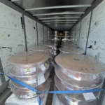 Two Trailers Containing $1.3M in Stolen Copper Wire Recovered in Illinois
  U.S. P/C Industry Books Best Result in a Decade, but Not All Lines Enjoy Success
  Executives on the Move at Arch, Allstate, Everest
  AI Pushes Underwriting Beyond Risk Selection to Prevention