


![]() RMS has released a new version of its North American Earthquake Models for the United States, Canada and Mexico.
RMS has released a new version of its North American Earthquake Models for the United States, Canada and Mexico.
The updated version 17.0 model will enable RMS clients to manage their risk accumulations with more confidence and underwrite a better book of business, said RMS, noting that more than “100 person-years of research and development” went into this new release.
RMS, the Newark, Calif.-based risk modeling and analytics firm, said the updated model lets it clients manage their risk accumulations with more confidence and underwrite a better book of business. It also noted that more than “100 person-years of research and development” went into this new release.
RMS “overcame significant technical and computational challenges” to deliver a model that is suitable for portfolio management and risk transfer as well as individual, more granular risk selection, Mohsen Rahnama, chief risk modeling officer at RMS, said in prepared remarks,
U.S. Earthquake Model
The reference point for the updated RMS United States Earthquake Model is the U.S. Geological Survey (USGS) 2014 national seismic hazard model, which incorporates the most comprehensive representation of earthquake hazards to date, said RMS in a statement.
As a result of its collaboration with the USGS, RMS noted, “the modeled average annual loss (AAL) and return period hazard in the RMS model remain true to those predicted by the full USGS event set – as does the tail risk.”
The updated RMS model now captures what is understood to be the potential for larger and more correlated seismic events in California, as well as new views of risk across all the regions of the U.S., the company added.
RMS said the model “now includes induced seismicity, making it the first available tool on the market for analyzing property risks from man-made earthquakes across Oklahoma, Kansas, Ohio, Arkansas, Texas, Colorado, New Mexico and Alabama. This function will allow clients of RMS to consider risks from earthquakes linked to oil and gas extraction.”
Canada Earthquake Model
The RMS Canada Earthquake Model incorporates an updated historical earthquake catalog, spanning nearly 400 years, and other hazard data from the Geological Survey of Canada.
RMS said the model includes all 10 provinces as well as the three Canadian territories. It also features a new Vancouver Basin Model to better capture the complex shaking amplification caused by the deep layers of soft, sedimentary rock in the area, in addition to a new suite of tsunami accumulation footprints for the west coast of Canada. This feature is also included in the U.S. model for the west coast of the United States.
Mexico Earthquake Model
The RMS Mexico Earthquake Model includes an updated, time-dependent view of the Mexico Subduction Zone that considers recent earthquakes and their likely impact on future events. In addition, there is increased definition of regional vulnerability in design and building practices, including seven micro-zones in Mexico City, with vulnerability regions at 100-meter resolution, RMS said.
“The framework for all three North America Earthquake Models is consistent, to offer firms greater ability to differentiate risk across the U.S., Canada and Mexico, using the new high resolution approach to characterizing local soil conditions and their impact on ground motion amplification,” RMS said.
The modeling company said it has invested “huge resources in an improved liquefaction model for the U.S., Canada and Mexico,” which leverages data from claims made after the Canterbury Earthquake Sequences in New Zealand, the second most expensive insured earthquake loss ever, globally.
Source: RMS
 NY AG Suing 3M, Other Chemical Companies Over PFAS Pollution
  AI Pushes Underwriting Beyond Risk Selection to Prevention
  Wendy’s, Chipotle Not Affected by Cyclosporiasis Outbreak
 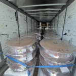 Two Trailers Containing $1.3M in Stolen Copper Wire Recovered in Illinois

