


If the nearly 4.3 million residential homes (1-4 units) across the country with substantial flood risk were to be insured through the National Flood Insurance Program, the NFIP rates would need to increase 4.5 times to cover the risk today.
New research, The Cost of Climate, from First Street Foundation, a nonprofit research and technology group working on flood risk, quantifies the financial impacts of flood risk carried by American homeowners and how those impacts are growing as flood risks worsen due to a rapidly changing climate.
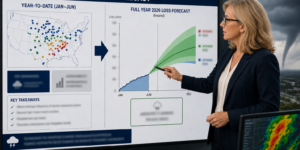
First Street Foundation researchers calculated average annual loss (AAL) statistics for each residential property in the contiguous United States, which is the dollar value of damage associated with flood risk each year. The foundation found that while the total expected annual loss for the estimated 4.3 million properties with substantial risk is $20 billion this year, it grows to nearly $32.2 billion a year in 30 years—an increase of 61 percent—due to the impact of a changing climate.
These estimates suggest the NFIP, which has lost more than $36 billion since its inception, will face growing losses in the years ahead without reform.
“Quantifying flood risk in economic terms creates a new context for homeowners to understand their risk and for buyers to consider when evaluating a property,” said Matthew Eby, founder and executive director of First Street Foundation. “Flood risk brings with it real and potentially devastating financial impacts that aren’t being priced into the market. We’re providing key insights into how flooding can impact the financial bottom line of property owners along with solutions that can protect their largest investment.”
The Foundation’s analysis was conducted in part with home value data acquired from ComeHome by HouseCanary.
The Federal Emergency Management Agency (FEMA), which runs the NFIP, is working to change the pricing of flood risk at the individual property level to more accurately reflect the risk of today’s climate through the forthcoming “Risk Rating 2.0” initiative. The FEMA rating change will set new premiums for properties both inside and outside of Special Flood Hazard Areas (SFHA) based on their individual flood risk.
However, that risk-based pricing has been delayed. FEMA had initially announced that new rates for all single-family homes would go into effect nationwide on Oct. 1, 2020 but decided it needed additional time to broaden its analyses of the proposed rating structure across its entire book of business so that it included communities behind levees. FEMA delayed implementation of Risk Rating 2.0 by one year to Oct. 1, 2021.
The FEMA extension means all NFIP policies—including single-family homes, multi-unit and commercial properties—could change over to the new rating system at one time instead of a phased approach as originally proposed.
Private flood insurers approach risk assessment and pricing differently and offer different limits and endorsements than the NFIP.
Climate Impact
First Street Foundation’s new report highlights the impact that climate change and a risk-based approach could have on individual homeowners. The 2.7 million properties at risk outside the SFHA would require a 5.2 times price increase to roughly $2,484 a year to cover their current risk. The 1.5 million properties within SFHAs, which are mandated to buy flood insurance if they hold a federally backed mortgage, would require an increase of 4.2 times to $7,895 a year.
“If the necessary adjustments to premiums were put in place to accurately reflect property-level risk, those homes which previously benefited most from group-based subsidized rates would see a reduction in their underlying value,” said Dr. Jeremy Porter, head of Research and Development at First Street Foundation.
First Street Foundation has added dollar estimates of flood damage for individual residential homes to its flood risk assessment tool Flood Factor. The new feature provides homeowners with flood damage cost estimates based on depth of flooding, demonstrates how these costs will change from today to 30 years from now due to a changing climate, and offers a cumulative projection of flood damage costs over the typical life of home ownership, or a 30-year mortgage.
In earlier research, First Street Foundation found that government-produced maps showing 8.7 million homes and properties at significant flood risk may have underestimated the amount of real estate at risk by 67 percent. Or, in other words, an additional six million properties face a significant risk of flood. The nonprofit is making accurate climate change-adjusted flood scores available for every property in the U.S. today.
NFIP Unchanged
The NFIP’s current rating structure has not fundamentally changed since the 1970s. It evaluates structures using their flood zone on a Flood Insurance Rate Map (FIRM), occupancy type and the elevation of the structure. FEMA’s nationwide rating system combines flood zones across many geographic areas and calculates expected losses for groups of structures that are similar in flood risk and key structural aspects, assigning the same rate to all policies in a group.
Under Risk Rating 2.0, according to FEMA, flood zones will no longer be used in calculating the premium. Instead, the premium will be calculated based on the specific features of an individual property, including structural variables such as the foundation type of the structure, the height of the lowest floor of the structure relative to base flood elevation and the replacement cost value of the structure.
Risk Rating 2.0 will also incorporate a broader range of flood frequencies and sources than the current system, as well as geographical variables such as the distance to water, the type and size of nearest bodies of water, and the elevation of the property relative to the flooding source.
Given the threat of sea-level rise, NFIP policymakers should rethink policies that encourage development in flood-prone regions, according to the Washington, D.C. think tank R Street.
R Street has proposed that the NFIP cease writing coverage for new construction in 100-year floodplains and that NFIP rates for any new construction should be adjusted to reflect future changes in assessments of flood risk. The study, Do No Harm: Managing Retreat By Ending New Subsidies, says that climate change will exacerbate the financial problem, as sea-level rise turns what once were 1-in-100-year floods into 1-in-10-year or even annual floods.
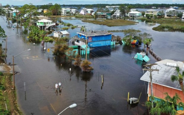
Top Photo: An aerial view from a drone shows people walking through a flooded street after Hurricane Sally passed through the area on September 17, 2020 in Gulf Shores, Florida. The storm came ashore with heavy rain and high winds. (Photo by Joe Raedle/Getty Images)
 U.S. P/C Industry Books Best Result in a Decade, but Not All Lines Enjoy Success
  Raised on Breaches, Digital Natives Think Differently About Cyber Risk
  Secondary Perils Responsible for Virtually All 2025 Nat-Cat Insured Losses in North America: Swiss Re
  Beyond the Weather News Bulletins: How Insurers Can Improve NatCat Responses


