


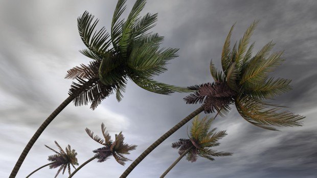
Atlantic storm watchers are going to have a hard time seeing the ocean, never mind any tropical systems, as another Saharan swirl of dust from Africa is moving west.
The dust, a marker for dry air, has spread out across the Atlantic and “that is really tamping down on the thunderstorm activity that we would typically see at this time of year,” said Jeff Masters, co-founder of Weather Underground in Ann Arbor, Michigan.
The usual recipe for tropical storms and hurricanes requires thunderstorms, moist air and warm ocean temperatures. You won’t find those ingredients now in the Atlantic region stretching from the Caribbean to Cabo Verde, off the coast of Africa.
That’s where a lot of the tropical action typically gets started this time of year, and then about two weeks later the Atlantic often will enter into its most frenetic phase.
For now though there aren’t many signs the basin is even stirring and until things change “you are not going to get much developing,” Masters said.
 Executives on the Move at SiriusPoint, Canopius Group, Badger Mutual
  Self-Driving Car Firms Must Address Emergency Vehicle Interference
  NY AG Suing 3M, Other Chemical Companies Over PFAS Pollution
  Wendy’s, Chipotle Not Affected by Cyclosporiasis Outbreak


