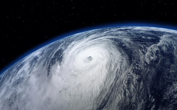
Super Typhoon Haiyan has made landfall over the Philippines as a strong Category 5 storm and is likely to be the strongest tropical cyclone to make landfall on record anywhere in the world, RMS said in a statement this morning.
According to the catastrophe modeling firm, previous economic losses have predominantly been below $1 billion and with the low insurance take-up, insured losses have not been significant for the industry overall.
The largest previous typhoon-related economic loss was super typhoon Bopha in 2012, which caused over 1,000 fatalities and led to economic losses of approximately $1 billion.
RMS says the non-life insurance market in the Philippines has been growing rapidly in recent years but penetration is still low compared to other markets in the region.
Haiyan’s maximum sustained winds of 195 mph (315 km/h), rains, and storm surge are expected to cause widespread devastation throughout the Central Philippines.
Storm surge heights are estimated to have exceeded five meters (16.4 feet) but could be as large as seven meters (23 feet) in some locations.
The storm is expected to make landfall over Central Vietnam early on Sunday 10 November at Category 2 strength.
Super typhoon Haiyan made landfall at 4:40AM (local) on Friday Nov. 8 over Guiuan, eastern Samar, in the eastern Visayan Islands of the Philippines. Haiyan made landfall as a category 5 Typhoon and could represent the strongest storm to have made landfall in any basin in the world.
At landfall, Super Typhoon Haiyan inflicted wind speeds estimated to be up to 195mph (322km/h) and storm surge heights estimated to exceed five meters (16.4 feet). In some coastal areas, storm surge heights reached seven meters (23 feet).
Wind speeds have weakened slightly but are still estimated to be in the region of 185mph (300km/h) as they pass over the central Philippines.
Before Haiyan, the strongest landfalling storm on record was hurricane Camille, which struck Mississippi, U.S. in 1969 with 190mph (306km/h) winds.
The previous strongest typhoon to strike the Philippines was Typhoon Bopha in 2012, with peak gust wind speeds of 175mph (282km/h).
The typhoon strength winds of super typhoon Haiyan are estimated to extend approximately 125 miles (200km) from its center. While not the largest observed storm, the track of Haiyan means that strong winds will have devastated the Central Philippines and impacted some of the Philippines largest cities.
Haiynan passed just north of Cebu City (fifth largest city, population approximately 1 million) and its northern periphery will impacted the Metro Manila region with strong winds and heavy rainfall (largest, population approximately 12 million). An estimated 12 million people are deemed at risk from the storm.
The Philippines is frequently impacted by typhoons. Haiyan is the fourth typhoon and the fifth named storm to impact the Philippines in 2013, which is above the average of 2.3 typhoons and three named storms (since 1945) to impact the country by this point in the season.
Storms that impact the Philippines more frequently impact the northern Philippine island of Luzon, though in 2012, one of the most devastating typhoons to affect the country, Super Typhoon Bopha made landfall over southern Philippines as a Category 5 storm causing major damage and over 1,000 fatalities.
October Asia Typhoon Activity at Record Status
2013 has been a busy typhoon season in the west Pacific, with 28 tropical storms since June, of which 16 have reached typhoon status (cat 1-5) and seven have reached super typhoon status (cat 4-5). Haiynan is the strongest typhoon to be observed in the 2013 season.
The 2013 West Pacific typhoon season has notably impacted Japan, Philippines, Vietnam, Taiwan, and China. In October alone the region saw the formation of eight tropical storms, seven of which reached typhoon status (Typhoons Fitow, Danas, Nari and Wipha, Francisco, Lekima and Krosa).
Typically in the West Pacific, October will produce an average of four named storms, three of which may reach typhoon status. Only the 1984 season has seen as many as eight named storms, and 2013 is the first season to produce seven typhoons in October.
Until now, Super Typhoon Lekima (active from October 19 to 26), was the season’s strongest typhoon, reaching the equivalent of a Category 5 hurricane. Fortunately Lekima stayed out in the open ocean, not impacting any land areas.
Source: RMS


 Executive Viewpoint: How AI Is Changing the Role of the Insurance Broker
  AI for the Defense: Should Insurers or Law Firms Pay?
  Officially Retired: Liberty Mutual’s Safeco Brand Sunsets
  Global Car Theft Ring That Used Electronic Devices to Reprogram Key Fobs Indicted
