


Yesterday, AIR Worldwide put estimates of the replacement value of properties ruined by Monday’s massive EF-5 tornado striking Moore, Okla. at more than $2 billion.
According to a statement released by the catastrophe modeling firm describing the track of the storm and the damage, the $2 billion figure coincides with a 0.4-mile zone around the track of the tornado (for a total width of 0.8 miles).
Within a 1-mile zone of the storm track (for a total width of 2 miles), AIR estimates a total replacement value of about $6 billion, AIR said.
AIR further explained that exposure within each zone is not equally at risk from damaging winds, noting that exposures on the periphery of the 1-mile zone would experience wind speeds of F-0 force, and hence much lighter damage, than exposures within the 0.4-mile buffer zone.

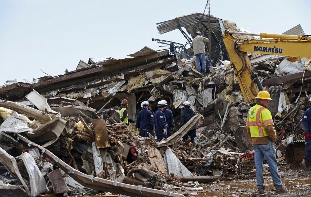
(Photo/The Oklahoman, Bryan Terry)
In the statement, Dr. Tim Doggett, senior principal scientist of AIR Worldwide described the origin of a tornado system that included the Moore tornado, which began on May 19 with a series of severe thunderstorm outbreaks in the Central Plains, as well as the atmospheric conditions that produced “tornadic supercell thunderstorms” by Monday afternoon, spawning the tornadoes.
Dr. Doggett continued, “In all, this system produced 22 tornadoes on May 20, largely in Oklahoma, although tornadoes were also reported in Missouri, Texas, Kansas, Arkansas, and Colorado. (However, of these 22 tornadoes, the Moore event was by far the most damaging.) Many localized hailstorms occurred in the region as well, with quarter-size hail noted in Missouri and baseball-size hail reported in Osage County, about 100 miles northeast of Oklahoma City.”
Specifically describing the Moore event with has been upgraded to an EF-5 rating by the National Weather Service, based on damage reports that are consistent with wind speeds of over 200 miles per hour, AIR said that reports and the size of the storm’s swath of destruction indicate that the tornado was approximately a mile wide.
With respect to warnings and preparation, AIR set forth this timeline of events:
- At 2:40 p.m., the National Weather Service Storm Prediction Center (SPC) alerted the town of Moore that a tornado was imminent.
- At 2:56 p.m., five minutes before the tornado struck, the SPC upgraded its emergency tornado warning to include “heightened language,” stating that those in the path of the storm would be facing a life threatening situation and must take cover in a basement, storm shelter, or interior room.
- At 3:01 p.m., the tornado struck Moore and continued northeast, nearly paralleling Highway 37, eventually dissipating about 5 miles east of Moore.
AIR noted that although basements and underground shelters are the safest refuge from a tornado, many homes in Oklahoma are built on concrete slabs—and thus lack basements—because the soil in the region renders basement construction too costly.
Dr. Doggett noted, “An official estimate of the number of destroyed homes has not yet been released; however, the 1999 EF-5 tornado that followed a similar path to Monday’s EF-5 Moore tornado destroyed more than 8,000 homes.”
Source: AIR Worldwide
 Let’s Talk About Insurance Distribution Before ChatGPT Disrupts It
  Mapfre to Acquire Safety Insurance in $1.5B in Cash Deal
  New Research Finds That Despite Improved Productivity, AI ROI Fails to Outpace Spend
  Waymo Driverless Cars Crash Less Than Human Drivers: IIHS Study